35 min read
EUDR Compliance System: How Precise Geodata Secures Market Access and Reduces Supply Chain Risks
By: Johannes Fiegenbaum on 5/27/25 7:59 AM · Last updated June 22, 2026
Executive Summary: The EU Deforestation Regulation (EUDR) requires precise geolocation data to prove deforestation-free sourcing. Companies placing relevant products on the EU market must implement robust due diligence systems with geocoordinates accurate to six decimal places. Non-compliance risks fines up to 4% of annual EU turnover, sales bans, and reputational damage. This guide explains technical requirements, differentiation between operators and traders, and practical implementation strategies for EUDR compliance.
Why Precise Location Data Is the Foundation of Your EUDR Compliance System
Precise geolocation data forms the cornerstone of any effective EUDR compliance system. Without accurate geocoordinates, companies cannot demonstrate that their supply chain is deforestation-free – a requirement that has become non-negotiable for EU market access since the European Parliament passed the EU Deforestation Regulation.
Live data: our Fiegenbaum Atlas provides green bond volumes, CSRD benchmarks, EU ETS prices, updated automatically. Open the dashboard.
Practitioner reality, 871 European CSRD reports 2025
- 70 percent of reports contain complete Scope 1, 2 and 3 data — coverage has risen markedly versus prior-year reports.
- 13 percent publish no extractable Scope data at all.
- 11 percent of reports with a Scope 3 figure show Scope 3 smaller than Scope 1 or 2, a methodological red flag (Scope 3 is typically five to ten times larger).
Source: 871 public 2025 reports from European listed companies
The regulatory requirements are unambiguous: location data must be provided in decimal degree format with at least six decimal places. This level of precision isn't bureaucratic overreach – it's the minimum standard needed to map production sites, verify against satellite monitoring data, and prove compliance during audits by competent authorities.
For companies managing complex supply chains, this represents both a technical challenge and a strategic opportunity. Those who implement robust data collection systems now position themselves as reliable partners for risk-averse buyers whilst competitors struggle with last-minute compliance efforts.
The Strategic Value of Geolocation Compliance
Beyond regulatory requirements, precise location data delivers measurable business advantages:
Risk mitigation: Early identification of deforestation risks in your supply chain before they escalate into compliance violations or supply chain disruptions.
Investor confidence: ESG-focused investors increasingly scrutinise supply chain traceability. Robust EUDR compliance demonstrates commitment to environmental protection and responsible sourcing practices. For more on ESG integration strategies, see our comprehensive guide.
Brand credibility: Consumer awareness of deforestation issues continues rising. Verified deforestation-free sourcing strengthens brand positioning, particularly in premium segments where sustainability credentials influence purchasing decisions.
Operational efficiency: Systematic geolocation data collection provides unprecedented visibility into production origins, enabling more strategic supplier engagement and informed sourcing decisions.
The numbers underscore the urgency: EU products contribute approximately 10% of global deforestation, whilst only 13% of companies have fully mapped their entire supply chain. This data gap represents significant compliance risk as EUDR enforcement intensifies.
Understanding EUDR Scope: Which Products and Commodities Require Due Diligence
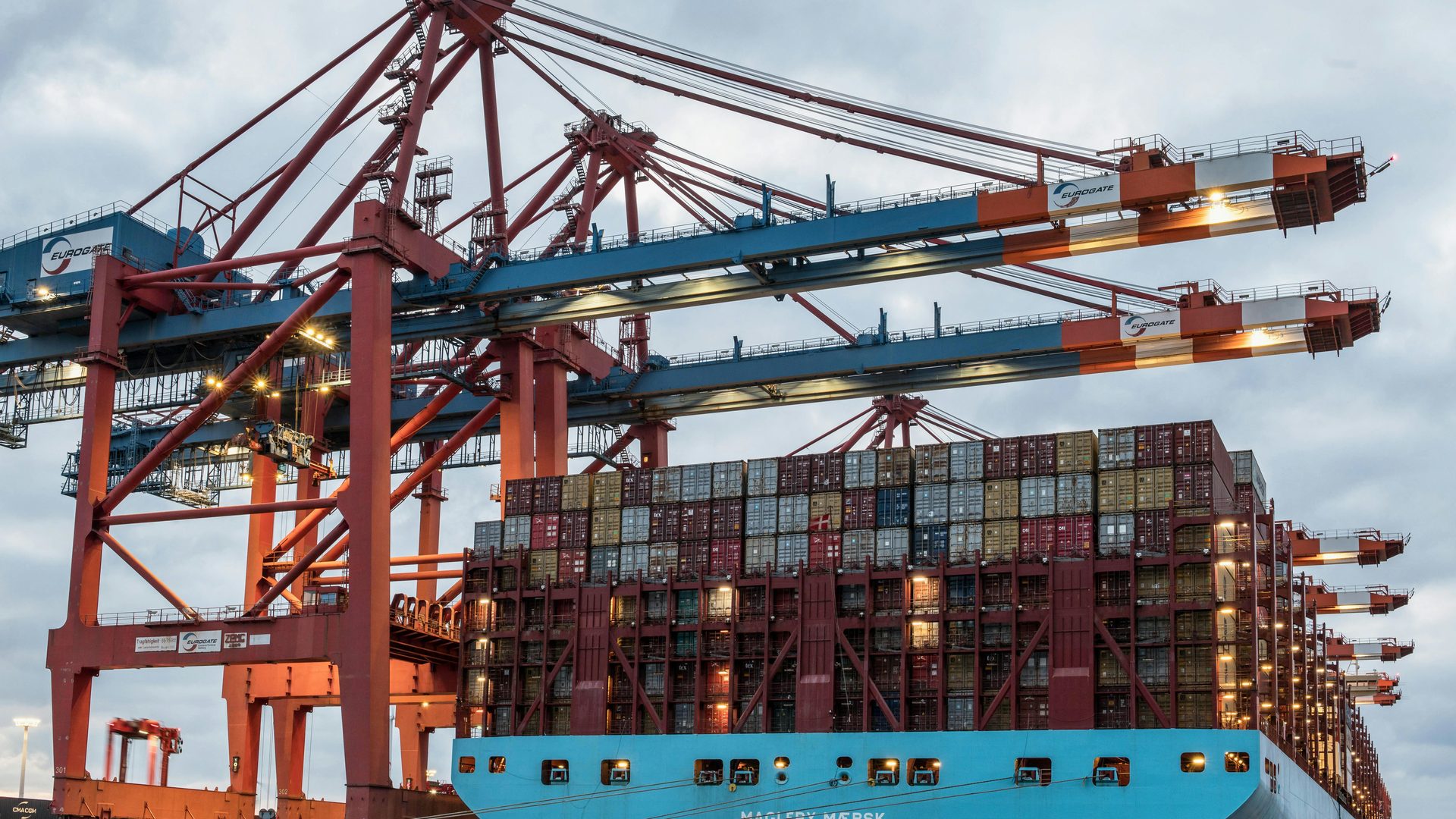
The EU Deforestation Regulation applies to seven core commodities and their derived products: cattle, cocoa, coffee, oil palm, rubber, soya, and wood. However, the actual scope of relevant products is more nuanced than this commodity list suggests.
Deforestation vs. Forest Degradation Under the EUDR
The regulation distinguishes clearly between two types of environmental damage:
Deforestation is defined as the conversion of forest to agricultural use since the cut-off date of 31 December 2020. This includes situations where forest is burned and later converted to cropland – even if conversion occurs years after the fire. However, forest that regenerates naturally after fire events and isn't converted to agricultural use is not considered deforested and can be utilised again.
Forest degradation specifically addresses the conversion of primary forests or naturally regenerating forests into plantation forests or other managed forest types. The EUDR focuses exclusively on degradation caused by logging and forest management practices, not degradation from climate events or natural disasters.
This distinction matters for risk assessments: a production site might technically remain forested but still violate EUDR if primary forest was converted to plantation forest for commercial production.
Which Products Are Actually Covered?
The product scope is narrower than many initially assumed. Only products explicitly listed in Annex I of the regulation and containing relevant commodities fall under EUDR requirements. A product with wood components isn't automatically covered – it must be classified under specific HS codes included in Annex I.
Packaging considerations: Packaging materials are covered only when placed on the EU market as standalone products. Pure transport or protective packaging classified together with the product content falls outside EUDR scope. This distinction significantly impacts compliance obligations for companies importing packaged goods.
Recycled materials: Products made entirely from recycled materials are exempt from EUDR requirements. However, mixed products containing any proportion of primary raw materials remain fully covered by the regulation – there's no proportional exemption based on recycled content percentage.
"Ex" HS codes: Some HS codes include the designation "ex", indicating that only specific sub-categories within that code are covered. Companies must verify whether their exact product specifications fall within covered sub-categories rather than assuming all products under that HS code require compliance.
Operators, Traders, and SMEs: Due Diligence Obligations Along the Supply Chain
The EUDR establishes distinct roles with different compliance obligations. Understanding whether your company functions as an operator, trader, or SME determines which due diligence processes you must implement.
Operators: Full Due Diligence Responsibility
Operators are entities that first place relevant products on the EU market or export them from the EU. This includes:
- Importers bringing products into the EU for the first time
- Manufacturers who process commodities into derived products
- Companies that change HS codes through processing (becoming "upstream operators")
Operators bear full responsibility for conducting due diligence and submitting due diligence statements before placing products on the market. This responsibility cannot be delegated – even if operators rely on supplier data, they remain liable for compliance failures.
For operators, the three-step due diligence process is mandatory:
- Information gathering: Collecting comprehensive data on product origins, including precise geolocation coordinates
- Risk analysis: Assessing deforestation risk based on collected information and external risk indicators
- Risk mitigation: Implementing measures to reduce identified risks to negligible levels
Traders: Conditional Due Diligence Requirements
Traders are entities that make relevant products available on the EU market after an operator has already placed them there. The regulation differentiates between large traders and SME traders:
Large traders (non-SME) have substantially the same obligations as operators. They can rely on due diligence declarations from upstream operators but remain jointly liable for compliance failures. This shared liability means large traders must verify the reliability of operator declarations rather than accepting them at face value.
SME traders benefit from simplified requirements. They must collect and retain reference numbers from upstream due diligence declarations and maintain documentation, but they're not required to conduct independent risk assessments or mitigation measures unless specific risk indicators emerge.
Authorised Representatives and Shared Responsibility
Companies outside the EU can appoint authorised representatives within the EU to fulfil operator obligations on their behalf. However, this doesn't eliminate the non-EU company's liability – both parties remain jointly responsible for compliance.
This shared responsibility model extends throughout the supply chain. Even when due diligence statements exist from upstream parties, downstream operators and large traders must exercise reasonable care in verifying these declarations. The regulation explicitly rejects "box-ticking" compliance in favour of substantive risk management.
For practical guidance on implementing ESG criteria across your organisation, our beginner's guide provides actionable frameworks.
Technical Requirements for Geolocation Data Under the EUDR
The EU Deforestation Regulation establishes precise technical standards for geolocation data that companies must meet to achieve compliance. These requirements aren't merely guidelines – they're mandatory specifications that competent authorities will verify during enforcement.
Required Accuracy and Data Format
Geolocation coordinates must be provided in decimal degree format with a minimum of six decimal places. Latitudes must fall between -90 and +90, whilst longitudes must range between -180 and +180. This precision level enables pinpoint identification of production sites when cross-referenced with satellite imagery.
The data requirements vary based on production area size:
| Area Size | Required Geodata | Format |
|---|---|---|
| > 4 hectares | Polygon with minimum 4 coordinate points (not in sequential order) | Longitude, Latitude (6 decimal places) |
| ≤ 4 hectares | Single coordinate point | Longitude, Latitude (6 decimal places) |
| Livestock operations | Single coordinate point | Longitude, Latitude (6 decimal places) |
For areas exceeding 4 hectares, companies must provide polygon coordinates that accurately outline production boundaries. These polygons require GeoJSON format, which has become the standard for geospatial data exchange due to its compatibility with mapping software and satellite monitoring systems.
Data Storage and Retention Obligations
All geolocation data must be retained for at least five years from the date the relevant products were placed on the EU market. This retention period applies regardless of whether products remain in inventory or have been sold – the obligation is tied to initial market placement.
Storage must ensure compatibility with the EU information system that competent authorities use for verification. Whilst the regulation doesn't mandate specific database systems, companies must be able to extract and share data in formats that authorities can process efficiently.
Regular updates are mandatory: Geolocation data isn't a one-time submission. Companies must continuously verify data accuracy using satellite monitoring and independent audits. When production sites change, processing facilities relocate, or new suppliers enter the supply chain, corresponding geolocation updates must occur within defined timeframes.
The maximum data volume per due diligence declaration is capped at 25 MB, which accommodates approximately 30,000–40,000 coordinate points. For companies with extensive production networks, this may require splitting declarations across multiple submissions.
Mass Balance Prohibition and Chain of Custody
A critical clarification from the EUDR guidance: mass balance chain of custody is explicitly prohibited. Companies cannot mix commodities from verified deforestation-free sources with materials of unknown or non-compliant origin, even if accounting systems track proportional volumes.
Physical segregation is required throughout the supply chain. Relevant products must remain separated from potentially non-compliant materials from production through processing, storage, and transportation. This doesn't necessarily require complete identity preservation for individual batches, but it does mandate clear physical separation between compliant and non-compliant inventory.
For companies accustomed to mass balance systems in other sustainability certifications, this represents a significant operational shift. Supply chain traceability systems must enable lot-level tracking with corresponding geolocation documentation for each distinct production origin.
Implementing Your EUDR Compliance System: From Data Collection to Risk Assessment
Building an effective EUDR compliance system requires systematic approaches to data collection, validation, and ongoing monitoring. The following framework guides companies through implementation whilst avoiding common pitfalls that delay compliance.
Supply Chain Data Collection Strategy
Begin with comprehensive mapping of all suppliers handling relevant commodities. For each supplier relationship, you need to collect:
- Precise production site coordinates in WGS84 format with six decimal places
- Production area measurements (to determine polygon vs. point coordinate requirements)
- Harvest or production dates relative to the 31 December 2020 cut-off
- Evidence that production complies with local laws in the country of origin
Multi-tier visibility is essential: many companies discover that their direct suppliers aren't the actual producers. You must trace back to origin – the farm, plantation, or forest where commodities were harvested. This often requires engaging multiple supply chain tiers and implementing systematic supplier engagement protocols.
Digital data collection tools dramatically reduce manual data transfer errors and improve data quality. Cloud-based platforms enable suppliers to submit geolocation data directly, with built-in validation rules that flag incomplete or improperly formatted coordinates before submission.
For companies just beginning climate risk assessments, the EUDR provides a useful framework for supply chain transparency that extends beyond deforestation.
Satellite Monitoring Integration
Satellite monitoring technologies have become indispensable for verifying geolocation data and analyzing deforestation risk. Current systems offer accuracy of ±5% to ±20% when assessing forest cover changes, with the capability to detect alterations in areas as small as 0.5 hectares.
Several commercial platforms provide end-to-end solutions for EUDR compliance:
TradeAware by LiveEO enables systematic collection and verification of supplier geolocation data through its Commercial Network feature. Companies can send business invitations to suppliers requesting precise location coordinates, creating a cascading data collection process throughout the supply chain.
Planet Labs delivers daily satellite imagery globally, enabling continuous monitoring of production sites. Their analysis tools automatically flag potential deforestation events, allowing companies to investigate concerning changes before they become compliance violations.
EOSDA (Earth Observing System Data Analytics) provides AI-powered analysis of satellite imagery specifically tailored to agricultural and forestry applications. Their platforms can track forest degradation indicators like canopy density changes that might indicate plantation conversion.
The shift from physical site inspections to data-driven remote verification significantly reduces costs whilst improving monitoring frequency. However, satellite monitoring complements rather than replaces supplier audits – high-risk situations still warrant on-ground verification.
Risk Assessment and Negligible Risk Determination
The EUDR introduces the concept of "negligible risk" as the compliance threshold, but companies must understand what this actually means in practice.
Negligible risk is not a status – it's the outcome of completing full due diligence on specific products. There's no such thing as a "negligible risk country" or "negligible risk commodity" that automatically exempts certain products from assessment. Even products from low-risk countries require information collection and documentation.
The three-step risk assessment process:
- Information collection: Gather all required data including geolocation coordinates, production dates, and evidence of legal compliance
- Risk analysis: Evaluate collected information against risk indicators such as deforestation alerts, local law compliance records, and third-party forest degradation reports
- Risk mitigation: When analysis identifies potential risks, implement measures like additional supplier audits, enhanced monitoring, or supplier development programmes until risk reaches negligible levels
Only after completing this process and documenting that risks have been reduced to negligible can companies submit due diligence statements. The burden of proof rests entirely with operators – competent authorities won't accept unsubstantiated negligible risk claims.
Digital Systems and Blockchain for EUDR Compliance
Technology infrastructure increasingly determines compliance efficiency. Companies that invest strategically in digital systems position themselves for sustainable competitive advantage whilst those relying on manual processes face escalating operational costs.
ERP System Integration Requirements
Effective EUDR compliance requires seamless integration of geolocation data into existing enterprise resource planning systems. This integration must support:
Automatic format conversion: Suppliers may provide coordinates in various formats. Your systems should automatically convert different coordinate formats into standardised GeoJSON for regulatory submissions whilst maintaining original data for audit trails.
Direct API connections: Modern ERP systems can connect directly to satellite monitoring platforms, pulling in deforestation alerts that automatically trigger internal reviews when production sites show concerning changes.
Multilingual data collection: International supply chains involve suppliers speaking different languages. Digital tools with multilingual interfaces reduce misunderstandings and improve data quality from non-English-speaking suppliers.
Batch-level traceability: Since mass balance is prohibited, ERP systems must enable lot-level tracking with corresponding geolocation documentation. When products from multiple origins are processed together, segregation and separate due diligence statements are required.
Companies without sophisticated ERP systems aren't excluded from compliance – specialised EUDR software platforms offer standalone solutions that integrate with basic accounting systems through standardised data exports.
Blockchain Applications for Immutable Records
Blockchain technology addresses one of EUDR's core challenges: proving data integrity over the mandatory five-year retention period. Once geolocation data is recorded on blockchain, it becomes tamper-proof, providing compelling evidence during regulatory audits.
Smart contracts enable automated compliance verification. Companies can program validation rules that automatically check whether submitted coordinates meet accuracy requirements, fall within legitimate production regions, and align with satellite-verified forest boundaries.
Ireland's agricultural sector pioneered blockchain solutions for supply chain traceability, demonstrating how decentralised ledgers enable transparent verification without compromising competitive confidentiality. Multiple parties along the supply chain can access verification data whilst proprietary commercial information remains protected.
The European Union actively supports blockchain innovation through its Digital Strategy framework. As Roberto Viola, Director-General of DG CONNECT, notes: "Europe's ambition is to set the gold standard for blockchain technologies... Administrations across Europe play a trailblazing role in implementing this exciting and essential new technology."
However, blockchain isn't a silver bullet. Implementation requires significant upfront investment, and value emerges primarily in complex multi-tier supply chains where traditional audit trails prove difficult to maintain. For companies with relatively simple, direct supplier relationships, conventional database systems may suffice.
For broader context on sustainable supply chain management, our guide explores additional compliance frameworks beyond EUDR.
GPS Field Data Collection: Technologies and Accuracy Standards
Ground-truth verification through GPS field data collection provides the foundation for reliable geolocation records. Modern GNSS (Global Navigation Satellite System) technologies deliver the precision necessary for EUDR compliance whilst remaining practical for suppliers across diverse geographic contexts.
Professional GNSS Equipment Options
High-precision GNSS systems represent significant investment but deliver survey-grade accuracy essential for large-scale operations:
Trimble R12i sets industry standards with real-time kinematic precision of 8 mm horizontally and 15 mm vertically. Its 672 GNSS channels simultaneously track GPS, GLONASS, Galileo, BeiDou, NavIC, QZSS, and SBAS satellites. This multi-constellation capability ensures reliable positioning even in challenging environments like dense forest canopy or mountainous terrain.
Trimble R2 offers cost-effective alternative with 10 mm horizontal and 20 mm vertical precision through 220 GNSS channels. For operations where millimetre-level accuracy isn't critical, the R2 delivers EUDR-compliant positioning at substantially lower price points.
Both systems integrate seamlessly with TerraFlex software, enabling field teams to collect geolocation data on tablets or smartphones that sync directly to cloud databases. This eliminates manual data transfer errors whilst providing real-time quality checks that flag improperly recorded coordinates before teams leave production sites.
Consumer-Grade GPS Alternatives
Not all suppliers require professional surveying equipment. Modern smartphones with GPS capabilities can achieve accuracy sufficient for EUDR compliance when used correctly:
Minimum requirements: Devices must support GPS/GNSS with clear satellite view and allow coordinate recording to six decimal places. Most smartphones manufactured since 2018 meet these specifications.
Best practices for mobile collection:
- Take readings from open areas away from buildings or dense vegetation
- Allow GPS lock for minimum 30 seconds before recording coordinates
- Collect multiple readings and average for improved accuracy
- Document collection conditions including weather and satellite count
Consumer GPS typically achieves 3-5 metre accuracy under good conditions – more than adequate for EUDR's six decimal place requirement (which translates to approximately 10cm theoretical precision). The challenge isn't technological capability but systematic collection protocols that ensure consistent data quality.
Field Data Collection Workflows
Efficient field data collection requires structured protocols:
- Pre-visit preparation: Load production site boundaries onto field devices using aerial imagery or existing maps
- Perimeter walking: For areas >4 hectares, walk boundaries collecting coordinates at 50-100 metre intervals
- Quality verification: Review collected polygons on-device to ensure complete coverage and logical boundaries
- Photo documentation: Capture georeferenced photos showing land use at each major coordinate point
- Immediate upload: Sync field data to central databases whilst still on-site to enable real-time quality control
This workflow creates verifiable audit trails linking geolocation data to specific collection dates, personnel, and ground conditions – documentation that proves invaluable during due diligence audits.
Consequences of Non-Compliance: Financial Penalties and Market Exclusion
The EUDR's enforcement framework combines substantial financial penalties with operational restrictions designed to exclude non-compliant products from the EU market. Understanding these consequences helps companies prioritise compliance investments relative to business risk.
Financial Penalties and Calculation Methods
Member states must establish penalty frameworks that are "effective, proportionate and dissuasive" for EUDR violations. The regulation sets maximum fines at 4% of total annual turnover in the EU – a penalty structure deliberately modelled on GDPR to signal regulatory seriousness.
Penalty calculation considers:
- Severity of the violation (isolated incident vs. systematic non-compliance)
- Environmental damage caused by deforestation or forest degradation
- Whether violations were negligent or intentional
- Company's cooperation with competent authorities during investigation
For context, Amazon faced a €746 million GDPR fine in 2021 that forced comprehensive overhaul of data protection practices. Whilst EUDR enforcement remains in early stages, similar penalty magnitudes signal regulatory intent to prioritise compliance over symbolic fines.
Operational Restrictions and Market Access
Beyond financial penalties, competent authorities wield extensive powers to restrict non-compliant companies:
| Enforcement Measure | Impact on Business Operations |
|---|---|
| Sales prohibition | Immediate ban on selling affected products in EU |
| Mandatory recall | Requirement to retrieve all products from market channels |
| Product donation/destruction | Obligation to donate or properly dispose of non-compliant goods |
| Temporary trade restrictions | Time-limited import/export ban for specific commodities |
| Simplified due diligence exclusion | Removal from expedited compliance procedures |
Cascade effects multiply direct penalties: a sales ban doesn't just block future transactions – it triggers contractual breaches with downstream customers, potential product liability claims, and reputational damage that extends beyond the specific violation.
Member states must report final judgements against companies to the European Commission within 30 days, creating permanent compliance records that influence future regulatory scrutiny. Companies with violation histories face heightened inspection probability and reduced regulatory discretion during subsequent audits.
ESG Rating Impacts and Investor Relations
Financial and operational penalties represent only immediate consequences. EUDR violations create lasting damage to ESG ratings that influence capital costs and investor confidence:
ESG rating agencies explicitly incorporate supply chain transparency and deforestation risks into sustainability assessments. A documented EUDR violation signals fundamental failures in supply chain governance that rating agencies interpret as broader ESG weakness.
Sustainable finance regulations including SFDR require asset managers to consider principal adverse impacts including deforestation in investment decisions. Companies with EUDR violations may find themselves excluded from Article 8 and Article 9 funds – dramatically reducing their investor base.
For insights on ESG integration for medium-sized companies, our comprehensive guide addresses broader sustainability reporting requirements.
Strategic Implementation Roadmap for EUDR Compliance
Building robust EUDR compliance requires systematic approaches that address both immediate regulatory obligations and long-term supply chain resilience. The following roadmap prioritises critical path activities whilst avoiding common implementation pitfalls.
Phase 1: Gap Analysis and Scope Determination (Months 1-2)
Product portfolio assessment: Review all products containing relevant commodities to determine which fall under Annex I coverage. Don't assume – verify specific HS codes and sub-categories ("ex" designations) that determine regulatory applicability.
Role clarification: Establish whether your company functions as operator, large trader, or SME trader for each product category. Companies often play different roles across product lines, requiring distinct compliance approaches.
Supply chain mapping: Document all current suppliers of relevant commodities, identifying how many supply chain tiers separate you from actual production sites. This initial mapping reveals blind spots where geolocation data doesn't currently exist.
Capability assessment: Evaluate internal systems for collecting, storing, and validating geolocation data. Most companies discover significant gaps between current data management capabilities and EUDR requirements.
Phase 2: Supplier Engagement and Data Collection (Months 2-6)
Supplier communication strategy: Develop clear messaging explaining EUDR requirements and what data you need from each supplier tier. Generic requests for "sustainability information" produce low-quality responses – specific geolocation requirements must be explicit.
Data collection platform selection: Implement digital tools that enable systematic data gathering with built-in validation. Companies attempting manual spreadsheet collection consistently underestimate effort required and suffer poor data quality.
Pilot programmes: Begin with highest-volume or highest-risk suppliers to test collection processes and identify operational challenges before full rollout. Lessons from initial pilots dramatically improve efficiency when scaling to complete supplier base.
Capacity building: Many suppliers – particularly smallholders in developing markets – lack technical capabilities for geolocation data collection. Companies that invest in supplier training and technology access achieve higher compliance rates with stronger relationships.
For practical frameworks, see our guide on materiality assessment for SMEs.
Phase 3: Risk Assessment Integration (Months 4-8)
Satellite monitoring deployment: Integrate satellite-based verification for all production sites with collected coordinates. Automated deforestation alerts enable proactive risk management before compliance violations occur.
Risk scoring methodology: Develop systematic approaches to evaluate and prioritise risks across supplier base. Not all risks warrant identical mitigation investments – strategic allocation to highest-priority situations maximises compliance whilst optimising resource deployment.
Mitigation protocol development: Establish clear procedures for responding when risk assessments identify concerning indicators. Ad-hoc responses to deforestation alerts create operational chaos and delayed decision-making.
Phase 4: System Integration and Automation (Months 6-12)
ERP integration: Connect geolocation databases with existing inventory management, procurement, and quality systems. Manual data transfers between systems create error risks and unsustainable operational overhead.
Workflow automation: Programme automated notifications when satellite monitoring detects potential issues, when supplier data requires updating, or when products approach five-year retention limits without archived documentation.
Audit trail documentation: Implement systematic recording of all due diligence activities – not just final conclusions but complete decision-making processes. Regulatory audits focus on demonstrating reasonable care, which requires comprehensive documentation of how conclusions were reached.
Low-Risk Countries, High-Risk Countries, and Risk-Based Due Diligence
The European Commission's classification of countries into low-risk, standard-risk, and high-risk categories significantly influences due diligence obligations, though it doesn't eliminate compliance requirements entirely.
Understanding Country Risk Classifications
Low-risk countries are those where the Commission determines, based on comprehensive assessment, that deforestation and forest degradation associated with relevant commodities occur at negligible levels. Products from low-risk countries still require information collection and documentation, but risk assessment and mitigation procedures can be simplified.
High-risk countries show concerning patterns of deforestation or forest degradation linked to relevant commodities. Products from these origins trigger enhanced due diligence requirements including more extensive supplier verification and potentially independent third-party audits.
Standard-risk countries (the default classification) require full three-step due diligence without simplified procedures but also without automatic enhancement requirements triggered solely by origin.
Critically, country classification doesn't create automatic compliance or non-compliance presumptions for specific products. A product from a low-risk country can still violate EUDR if company-specific due diligence reveals deforestation occurred after 31 December 2020. Conversely, products from high-risk countries aren't automatically non-compliant – they simply require more rigorous verification.
Simplified Due Diligence for Low-Risk Origins
For products originating from low-risk countries, companies can implement streamlined processes:
Information requirements remain unchanged: Collection of geolocation data, production dates, and legal compliance evidence is still mandatory. The simplification doesn't reduce data collection obligations.
Risk assessment modifications: Companies can reduce depth of risk analysis when credible concerns don't emerge from collected information. However, if specific risk indicators appear (e.g., supplier proximity to recently deforested areas), full risk assessment becomes necessary regardless of country classification.
Reduced mitigation burdens: When risk assessments confirm low risk, extensive mitigation measures aren't required. Standard supplier management practices may suffice rather than enhanced monitoring protocols.
The Commission updates country classifications periodically based on evolving forest data. Companies must monitor these updates and adjust due diligence procedures when countries transition between risk categories.
Enhanced Due Diligence for High-Risk Origins
Products from high-risk countries trigger more rigorous verification requirements:
Enhanced information gathering: Beyond basic geolocation coordinates, companies should collect supporting documentation like land tenure certificates, forest management plans, or harvest permits demonstrating legal compliance.
Third-party verification: Independent audits of high-risk suppliers provide additional assurance that internal due diligence processes might miss. This is particularly valuable when companies lack local market knowledge in production regions.
Increased monitoring frequency: Rather than annual supplier reviews, products from high-risk origins warrant quarterly or even monthly satellite monitoring to detect potential issues before they escalate.
Some companies implement tiered supplier segmentation, allocating due diligence resources proportional to risk profiles. Highest-risk suppliers receive intensive monitoring whilst lower-risk relationships use standard procedures. This risk-based allocation optimises compliance costs whilst maintaining regulatory conformity.
For broader approaches to identifying and managing supply chain risks, our guide addresses climate-related vulnerabilities beyond deforestation.
Integration with Broader ESG and Sustainability Reporting
EUDR compliance shouldn't exist as isolated regulatory exercise – strategic companies integrate deforestation due diligence into comprehensive ESG frameworks that address multiple stakeholder expectations simultaneously.
EUDR and CSRD Alignment Opportunities
The Corporate Sustainability Reporting Directive (CSRD) requires covered companies to report on biodiversity impacts and supply chain environmental risks. EUDR due diligence generates precisely the supply chain transparency data that CSRD reporting demands.
Geolocation data collected for EUDR serves double duty in CSRD disclosures about production site environmental impacts. Rather than maintaining separate data systems, companies can leverage EUDR infrastructure for broader sustainability reporting.
Risk assessment methodologies developed for deforestation analysis translate directly to climate risk assessments and biodiversity impact evaluations. The analytical frameworks are fundamentally similar even when specific risk indicators differ.
Supplier engagement protocols established for EUDR data collection create communication channels useful for gathering broader ESG data. Once suppliers provide geolocation coordinates, requesting energy consumption data or social compliance certifications adds marginal effort.
Strategic integration reduces total compliance costs whilst improving data consistency across reporting frameworks. For detailed CSRD implementation guidance, see our article on CSRD sustainability reporting best practices.
EUDR's Role in Science-Based Targets
Companies pursuing Science Based Targets initiative (SBTi) certification must address land-use change emissions in their climate strategies. Deforestation in agricultural supply chains represents significant Scope 3 emissions that SBTi requires companies to measure and reduce.
EUDR compliance data provides the supply chain visibility necessary for accurate Scope 3 land-use calculations:
Production site geolocation enables precise estimation of emissions from land conversion when cross-referenced with satellite-based carbon stock databases.
Temporal data (harvest dates relative to the 31 December 2020 cut-off) establishes baselines for measuring emissions reductions over time.
Commodity-specific traceability allows attribution of emissions to specific product lines – essential for setting meaningful reduction targets rather than company-wide averages that obscure problematic supply chains.
Companies that treat EUDR as mere compliance exercise miss opportunities to leverage collected data for SBTi submissions, climate disclosures, and investor communications about decarbonisation progress.
Supply Chain Transparency for Impact Investors
Venture capital and private equity investors increasingly require portfolio companies to demonstrate supply chain sustainability. EUDR compliance provides credible evidence of responsible sourcing that addresses investor due diligence concerns.
Article 8 and Article 9 funds under SFDR must report on portfolio companies' environmental impacts including deforestation. Companies with robust EUDR compliance become more attractive investment targets for sustainability-focused funds managing €2+ trillion in assets.
ESG due diligence in M&A transactions scrutinises supply chain environmental risks. Companies with established EUDR systems avoid deal delays and valuation discounts triggered by identified compliance gaps.
For insights on ESG value creation in venture capital, our guide explores strategic approaches beyond regulatory compliance.
Practical Due Diligence: From Information Gathering to Declaration Submission
Translating EUDR requirements into operational workflows requires detailed procedures that staff can execute consistently across diverse product categories and supplier relationships.
Step 1: Information Collection Protocols
Standardised data request templates ensure suppliers understand exactly what information you need. Generic requests produce inconsistent responses that require multiple follow-ups – specific templates asking for coordinates in decimal degrees with six decimal places, area measurements in hectares, and precise harvest dates dramatically improve first-time data quality.
Collection timing: Request geolocation data during initial supplier qualification rather than waiting until products are ready to ship. Last-minute data requests create bottlenecks and pressure to accept incomplete information to avoid shipment delays.
Verification requirements: Collect supporting documentation that enables independent verification:
- Satellite imagery of production sites at relevant dates
- Land tenure certificates or harvest permits
- Previous sustainability certifications (though these don't substitute for EUDR-specific data)
- Commercial invoices and shipping documents establishing chain of custody
Data quality checks: Implement automated validation before accepting supplier submissions:
- Coordinates fall within legitimate production regions for specific commodities
- Latitude/longitude values are within valid ranges (-90 to +90, -180 to +180)
- Polygon coordinates for areas >4 hectares actually form closed shapes
- Harvest dates fall after the 31 December 2020 cut-off date
Step 2: Risk Analysis Execution
Once information is collected, systematic risk analysis identifies products requiring mitigation:
Geospatial risk screening: Cross-reference production site coordinates with:
- Global Forest Watch deforestation alerts
- Hansen forest loss datasets showing tree cover changes
- Protected area boundaries and conservation zones
- Country-specific forest monitoring systems
Legal compliance verification: Confirm production complies with laws in the country of origin:
- Land use permissions and forest conversion authorisations
- Indigenous peoples' rights and community consultation requirements
- Protected species regulations
- Labour standards and minimum wage compliance
Contextual risk factors: Consider broader indicators beyond geospatial data:
- Supplier history of environmental violations
- Presence in regions with documented illegal logging or land grabbing
- Commodity price volatility that incentivises illegal deforestation
- Weak governance and enforcement in production countries
Document all risk analysis activities – regulatory audits focus on demonstrating reasonable care in how risks were identified and evaluated, not just final conclusions.
Step 3: Risk Mitigation Strategies
When risk analysis identifies concerns, implement proportional mitigation:
Enhanced monitoring: Increase satellite monitoring frequency for flagged production sites, potentially monthly reviews rather than annual assessments.
Supplier audits: Commission independent third-party verification of high-risk suppliers, including site visits that confirm geolocation data accuracy and forest status.
Alternative sourcing: Develop backup suppliers from lower-risk origins to reduce dependence on problematic sources whilst maintaining supply continuity.
Supplier development: Work with suppliers showing good-faith commitment to invest in improved practices, land use planning, or certification schemes that reduce underlying risks.
Mitigation must continue until risks reach negligible levels – there's no regulatory threshold accepting "low but not negligible" risk as sufficient for compliance.
Step 4: Due Diligence Declaration Submission
Only after completing information collection, risk analysis, and mitigation (if required) can companies submit due diligence statements to the EU information system:
Reference number generation: Each declaration receives unique reference number that must appear on all documentation and be shared with downstream operators and traders.
Data volume limits: Individual declarations are capped at 25 MB (approximately 30,000-40,000 coordinate points). Companies with extensive production networks split across multiple declarations whilst maintaining clear links between related submissions.
Update obligations: Declarations aren't perpetual – companies must update when:
- Production sites change
- New suppliers enter the supply chain
- Risk assessments reveal previously unknown concerns
- Country classifications change affecting due diligence requirements
For operational guidance on sustainability reporting for SMEs, our article explores reporting frameworks that complement EUDR compliance.
Sector-Specific Challenges: Palm Oil, Coffee, Cocoa, and Cattle
Different relevant commodities present distinct compliance challenges based on production characteristics, supply chain structures, and data availability. Understanding sector-specific issues enables more effective due diligence strategies.
Palm Oil: Plantation Complexity and Smallholder Inclusion
Palm oil supply chains typically involve both large plantations with sophisticated management systems and smallholder farmers lacking digital infrastructure. This dual structure creates compliance challenges:
Large plantations generally maintain detailed production records and can provide accurate geolocation data. However, verification must confirm that plantations weren't established through primary forest conversion – even if conversion occurred decades ago and predates EUDR cut-off dates, forest degradation provisions may apply if primary forest was converted to plantation forest.
Smallholder farmers (often owning <2 hectares) require significant capacity building to collect geolocation data. Mobile-based collection tools with simplified interfaces and local language support prove essential for achieving meaningful smallholder participation.
Mill aggregation points present traceability challenges: palm oil from dozens or hundreds of producers mixes at mills before processing. Since mass balance is prohibited under EUDR, mills must implement segregation systems tracking specific production origins through processing stages.
Coffee and Cocoa: Fragmented Production and Farmer Cooperatives
Coffee and cocoa production predominantly involves smallholder farmers organised through cooperatives or trader networks. Key compliance considerations:
Cooperative structures can facilitate efficient data collection: rather than engaging thousands of individual farmers, companies can work through cooperatives that collect member geolocation data systematically. However, cooperative data quality varies dramatically – independent verification ensures reliability.
Shade-grown vs. sun-grown cultivation affects deforestation risk profiles: shade-grown coffee and cocoa under existing tree cover presents lower risks than sun cultivation requiring forest clearing. Geolocation data should specify cultivation methods enabling risk-proportional due diligence.
Seasonal production patterns mean harvest timing significantly influences cut-off date compliance. Coffee and cocoa harvested in early 2021 might come from trees planted in 2019 when deforestation occurred – simply verifying 2021 harvest dates doesn't confirm compliance.
For coffee specifically, see our analysis of EUDR's impact on coffee supply chains.
Cattle: Indirect Land Use and Pasture Rotation
Cattle production presents unique challenges for geolocation data collection:
Pasture mobility: Cattle often graze across extensive areas with seasonal rotation patterns. EUDR requires coordinates for where cattle were raised, not just current location – this necessitates historical pasture use records many ranchers don't maintain.
Indirect land use change: Cattle production may displace other agriculture into forested areas even when ranches themselves don't directly clear forest. Comprehensive risk assessment must consider regional land use dynamics beyond individual production sites.
Feedlot finishing: Cattle raised in one location and finished in feedlots elsewhere require geolocation data for both sites. This becomes particularly complex when cattle ownership changes multiple times during production cycles.
Leather supply chains sourced from cattle require traceability from slaughterhouses back to ranches – a connection that current systems often don't maintain. Companies importing leather products face substantial implementation challenges establishing ranch-level traceability.
Future Regulatory Developments and Strategic Positioning
The EUDR represents first generation of EU supply chain environmental regulations. Understanding likely regulatory evolution helps companies build compliance systems that remain viable as requirements expand.
Anticipated Scope Expansions
Current political discussions suggest potential future extensions:
Additional commodities: Maize and sugarcane frequently appear in proposals to expand covered commodities. Companies in food processing or biofuels should monitor these discussions and potentially implement voluntary due diligence systems anticipating future requirements.
Ecosystem conversion beyond forests: Some policymakers advocate expanding coverage to other ecosystem conversions including grasslands, wetlands, and savannas. This would fundamentally broaden scope beyond current forest focus.
Downstream product expansion: Current Annex I focuses on primary products and immediate derivatives. Future revisions might capture more extensively processed products further removed from original commodities – requiring due diligence from companies currently outside scope.
Integration with Other EU Regulations
EUDR operates alongside expanding regulatory landscape including:
Corporate Sustainability Due Diligence Directive (CSDDD): Once implemented, CSDDD will require human rights and environmental due diligence across supply chains extending beyond EUDR's commodity focus. Companies can achieve efficiencies implementing integrated systems addressing both regulations simultaneously.
Carbon Border Adjustment Mechanism (CBAM): As CBAM expands beyond current heavy industry focus, agricultural products may face carbon-based import obligations. Combined EUDR and CBAM compliance might require coordinated geolocation and emissions data collection.
For insights on navigating EU omnibus package changes, our article addresses broader sustainability reporting developments.
Competitive Positioning Through Early Compliance
Companies that view EUDR as competitive opportunity rather than compliance burden position themselves strategically:
Market access advantages: As enforcement intensifies, companies with robust compliance systems secure preferential supplier relationships with risk-averse buyers whilst competitors face excluded suppliers and constrained sourcing options.
Premium market positioning: Consumer willingness to pay for verified deforestation-free products continues growing. Credible EUDR compliance provides marketing differentiation, particularly in premium and organic segments where sustainability credentials influence purchasing.
Investor relations benefits: Early compliance demonstrates management capability to navigate complex ESG regulations – a signal increasingly valuable to investors evaluating governance quality and regulatory risk management.
Frequently Asked Questions (FAQs)
Why are exact geocoordinates with at least six decimal places essential for EUDR compliance?
Six decimal place precision enables pinpoint identification of production sites at approximately 10cm accuracy. This precision level is necessary to cross-reference production locations with satellite imagery showing forest cover changes, verify that sites fall within legitimate production areas rather than protected forests, and demonstrate to competent authorities that due diligence is based on accurate location data rather than approximations. Coordinates with fewer decimal places create verification problems when satellite imagery shows ambiguous results near forest boundaries.
Which technologies help companies capture and verify precise location data for EUDR requirements?
Professional GNSS systems like Trimble R12i deliver survey-grade accuracy (8mm horizontal, 15mm vertical) ideal for large-scale operations requiring maximum precision. Consumer smartphones with GPS capabilities provide sufficient accuracy (3-5 metres) for most EUDR applications when used correctly with proper satellite lock times. Satellite monitoring platforms including TradeAware (LiveEO) and Planet Labs enable continuous verification of production sites against forest cover databases. Blockchain systems provide immutable record-keeping for geolocation data, creating tamper-proof audit trails for the required five-year retention period. The optimal technology mix depends on production scale, supplier sophistication, and risk profile.
What are the consequences for companies that do not comply with EUDR requirements?
Financial penalties reach up to 4% of total annual EU turnover – potentially hundreds of millions of euros for large corporations. Competent authorities can impose sales bans preventing market placement of non-compliant products, mandate product recalls requiring retrieval and destruction of goods already distributed, and implement temporary trade restrictions blocking imports of specific commodities from repeat violators. Beyond immediate penalties, EUDR violations create lasting ESG rating damage that increases capital costs, excludes companies from sustainable investment funds managing trillions in assets, and undermines brand reputation with sustainability-conscious consumers. Member states report final judgements to the European Commission within 30 days, creating permanent compliance records affecting future regulatory scrutiny.
How do operators, traders, and SMEs differ in their EUDR obligations?
Operators who first place relevant products on the EU market bear full due diligence responsibility including information collection, risk analysis, and mitigation. This applies to importers, manufacturers changing HS codes, and exporters. Large traders (non-SME entities making products available after initial market placement) have substantially identical obligations to operators despite not being first movers – they can rely on operator declarations but remain jointly liable for compliance failures. SME traders benefit from simplified requirements: they must collect and retain reference numbers from upstream due diligence statements but aren't required to conduct independent risk assessments unless specific concerns emerge. All three categories must maintain documentation for minimum five years regardless of simplified procedures.
Can companies use mass balance chain of custody systems for EUDR compliance?
No – the EUDR explicitly prohibits mass balance systems. Relevant products must remain physically segregated from materials of unknown or non-compliant origin throughout the entire supply chain from production through processing, storage, and transport. Accounting systems that track proportional volumes of compliant materials mixed with non-compliant inventory don't satisfy regulatory requirements. This represents significant operational shift for companies accustomed to mass balance in other sustainability certifications. Practical implementation requires lot-level tracking with corresponding geolocation documentation for each distinct production origin, potentially necessitating parallel processing lines or temporal segregation where compliant and non-compliant materials use same facilities at different times.
How do low-risk country classifications affect due diligence requirements?
Products from low-risk countries still require complete information collection including geolocation data, production dates, and legal compliance evidence – the classification doesn't reduce data gathering obligations. However, risk assessment and mitigation procedures can be simplified when collected information doesn't reveal specific concerns. If risk indicators emerge (such as supplier proximity to recently deforested areas), full due diligence becomes necessary regardless of country classification. The European Commission updates country classifications periodically based on evolving forest data, requiring companies to monitor changes and adjust procedures when countries transition between risk categories. Importantly, country classification creates no automatic compliance presumptions – products from low-risk countries can still violate EUDR if company-specific due diligence reveals post-2020 deforestation.
What is the relationship between EUDR and forest degradation?
EUDR addresses both deforestation (conversion of forest to agricultural use) and forest degradation (conversion of primary or naturally regenerating forests into plantation forests or other managed types). Forest degradation provisions focus on changes caused by logging and forest management practices rather than climate events or natural disasters. This distinction matters particularly for wood and palm oil supply chains where plantation forests are common. A production site might technically remain forested but still violate EUDR if primary forest was converted to commercial plantation for production purposes. Risk assessments must evaluate both deforestation and degradation indicators when analysing compliance status of specific production sites.
How long must companies retain EUDR due diligence documentation?
All geolocation data, risk assessments, and supporting documentation must be retained for at least five years from the date relevant products were placed on the EU market. This retention obligation continues regardless of whether products remain in inventory or have been sold – it's tied to initial market placement. Documentation must remain accessible for competent authority audits throughout the retention period, requiring robust data management systems that prevent accidental deletion or corruption. Companies must also update documentation when production sites change, new suppliers enter supply chains, or risk assessments reveal previously unknown concerns – these updates create new five-year retention periods for modified information.
Common EUDR Geodata Implementation Challenges and Solutions
Despite clear technical requirements, many operators encounter significant obstacles when building out their EUDR geodata infrastructure. One of the most persistent challenges is supplier reluctance: smallholder farmers and first-mile aggregators in high-risk sourcing regions often lack the digital tools, connectivity, or incentives to collect and transmit precise polygon data. Operators who treat geodata collection as a purely technical exercise—rather than a relationship-driven process—frequently hit walls that delay compliance timelines well into production cycles.
Data quality inconsistencies present a second major hurdle. Coordinates collected via low-accuracy GPS devices, manually transcribed plot boundaries, or legacy cadastral records often fail to meet the sub-hectare precision standards required under EUDR Article 9. Solutions include deploying mobile field-collection apps with built-in validation logic, partnering with certified remote-sensing providers who can cross-reference submitted polygons against satellite-derived land cover layers, and establishing clear contractual data quality standards with upstream suppliers.
Finally, integrating heterogeneous geodata formats from multiple sourcing countries into a single compliance system remains technically demanding. Organisations that invest early in standardised data schemas—aligned with the EU Information System for EUDR—and that build flexible API connectors into their existing ERP or traceability platforms are best positioned to absorb future regulatory updates without costly system overhauls.
ROI and Competitive Advantage: Why Early Geodata Compliance Pays Off
Framing EUDR compliance purely as a cost centre underestimates its strategic value. Companies that have already operationalised verified geodata collection and deforestation-risk assessment are gaining measurable procurement advantages: major European retailers and food manufacturers are increasingly prioritising suppliers who can demonstrate clean, auditable supply chains over those who can only offer self-declarations. Early movers reduce the risk of last-minute market exclusion—a scenario that has already materialised for several cocoa and palm oil traders following tightened retailer sourcing policies in 2025 and early 2026.
The return on investment becomes particularly visible when compliance infrastructure is designed to serve multiple purposes simultaneously. Verified plot-level geodata supports not only EUDR due diligence but also carbon footprint calculations, biodiversity impact assessments, and Scope 3 emissions reporting under the Corporate Sustainability Reporting Directive. Operators who build modular, interoperable data systems avoid redundant audit processes and reduce per-unit compliance costs significantly over a three-to-five-year horizon.
Beyond direct cost savings, precise traceability enables premium positioning. A growing segment of institutional buyers in Germany, France, and the Netherlands is willing to pay differentiated prices for commodities backed by polygon-level provenance data and third-party verified forest monitoring. In competitive commodity markets, this pricing power—combined with reduced regulatory exposure—makes a compelling financial case for accelerating geodata investment rather than waiting for enforcement pressure to force action.
Take Action: Implementing Your EUDR Compliance System
The EU Deforestation Regulation fundamentally reshapes supply chain transparency requirements for companies placing relevant products on the EU market. Precise geolocation data isn't merely bureaucratic compliance – it's the foundation for proving deforestation-free sourcing, maintaining market access, and protecting brand reputation.
Key implementation priorities:
Start immediately with supply chain mapping to identify blind spots where geolocation data doesn't currently exist. The compliance deadline continues approaching whilst supplier engagement and data collection require substantial time investments.
Invest strategically in digital systems that enable efficient data collection, validation, and ongoing monitoring. Manual processes don't scale when managing thousands of production sites across multiple commodity categories.
Integrate EUDR with broader ESG frameworks including CSRD reporting, Science Based Targets, and investor relations communications. Isolated compliance efforts miss opportunities to leverage collected data for multiple stakeholder audiences.
Build supplier relationships based on partnership rather than purely transactional data requests. Suppliers with technical and financial support deliver higher-quality information whilst maintaining long-term commitment to deforestation-free production.
The companies that thrive under EUDR aren't those treating it as minimal compliance exercise – they're organisations recognising supply chain transparency as competitive advantage. Verified deforestation-free sourcing strengthens investor confidence, differentiates brands in premium markets, and positions companies strategically as regulatory requirements inevitably expand.
Ready to build your EUDR compliance system? Explore our climate risk assessment services or book a consultation to develop tailored strategies for your supply chain complexity.
For additional resources:

Johannes Fiegenbaum
ESG and sustainability consultant based in Hamburg, specialised in VSME reporting and climate risk analysis. Has supported 300+ projects for companies and financial institutions – from mid-sized firms to Commerzbank, UBS and Allianz.
More aboutYou may also like
EUDR Due Diligence: Compliance Requirements
The EU Deforestation Regulation (EUDR) has undergone significant updates in November 2025, with the European Commission officially postponing the application deadline by 12 ...
Read more →